
What Verra's VT0014 actually permits for digital soil mapping
Verra's VT0014 lets soil carbon projects use digital soil mapping in place of dense physical sampling. The soil core does not disappear; its job changes from measuring an average to validating a model. Sampling volume falls furthest where regional soil data already exists, and least in data-scarce landscapes. Three risks move with the cost: accuracy figures validated against training rather than withheld data, models that do not transfer across soil-climate combinations, and dependency on a model licence.
From measurement to validation
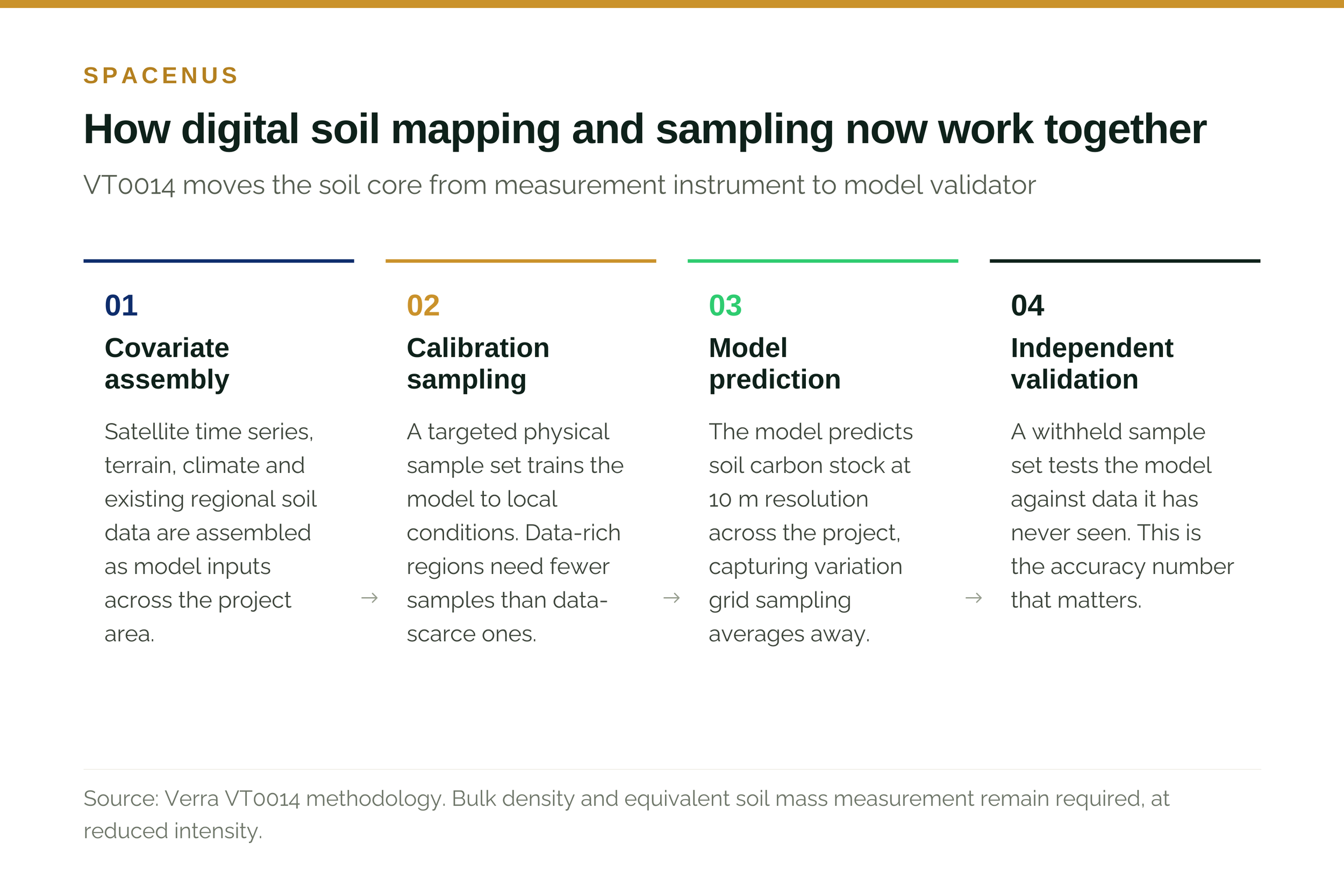
Under conventional VM0042 sampling, you take enough cores to estimate a mean with acceptable uncertainty. The samples are the measurement. Under VT0014, a model predicts soil carbon stock across the project area and the samples test whether the model is right. The samples are the audit.
That sounds like a technical distinction. Commercially it is a large one, because the number of samples required to validate a model is much smaller than the number required to characterise a landscape directly, and because the thing you are now buying is a model, with all that implies about transparency and vendor dependency.
What happens to sampling volume
Verra designed VT0014 to reduce physical sampling substantially relative to conventional VM0042 practice. How far, in any given project, depends almost entirely on how much soil data already exists in the region. A project in a landscape covered by a dense national soil survey needs relatively few calibration points. A project in a data-scarce landscape needs enough samples to train a model locally before it can predict anything.
Several sampling-reduction figures circulate in this market and they are routinely quoted interchangeably, which is unhelpful. They describe different things.
Read them as four separate statements about four separate interventions. Verra’s figure is a methodology design objective. The stratification figure is monitored performance in specific customer projects. The two literature figures come from controlled comparisons of sampling designs at equivalent accuracy. None of them is a promise about your project.
The hybrid model
VT0014 pairs digital soil mapping with process-based modelling. Digital soil mapping supplies a high-resolution baseline, typically 10 m pixels, that captures the spatial variation grid sampling averages away. Process models such as RothC then simulate how that carbon changes over time under given management and climate.
Each improves the other. The process model needs an accurate starting point, which the map provides. The map needs a mechanism for change over time, which the process model provides. Neither is sufficient alone.
Bulk density and equivalent soil mass remain mandatory. Bulk density converts carbon concentration to carbon stock; equivalent soil mass makes comparisons across years honest when tillage has changed the soil profile. Both need physical measurement, at reduced intensity.
Where the risk moved
Lower sampling cost buys you a new set of exposures, and they are less familiar than the ones they replaced.
Accuracy claims are not comparable
A model tested against its own training data will report a flattering number. The same model tested against independent, withheld data will report a lower and more useful one. When a provider quotes an accuracy figure, the question worth asking is what it was validated against and whether that validation set was genuinely held out.
This applies to us too. Where Spacenus publishes a precision figure, for instance the greater than 90% NDVI precision of our FUSION cloud-penetrating model - it should be read the same way, and we will supply the validation protocol on request. A verification company that will not show its validation method is asking you to take verification on trust, which defeats the point.
“If a verification company will not show you how its accuracy figure was validated, it is asking you to take verification on trust. That is precisely the thing verification exists to replace.” — Riazuddin Kawsar, CEO, Spacenus
Models do not transfer
The statistical relationship between satellite observation and soil carbon is specific to a soil-climate combination. A model calibrated on temperate European arable soils will not perform on tropical oxisols without local recalibration. There is no global plug-and-play solution, and vendors implying otherwise should be treated with caution.
Vendor dependency is now a real line item
When you were buying samples, you were buying a commodity service. When you are buying a model licence, you are buying into a provider’s roadmap, pricing and continuity. That is a manageable risk, but it is one to negotiate deliberately rather than discover at renewal.
What changes commercially
The unit of pricing shifts. Under VM0042 the natural line item was cost per sample. Under VT0014 it is a blended figure, model licence plus targeted sampling, which makes cost per sample a meaningless comparison and cost per credit generated the only sensible one.
There is a second-order effect worth planning for. A 10 m soil carbon map has uses beyond the credit calculation: variable-rate planning, zone management, field prioritisation. Projects that treat the map purely as a compliance artefact leave value on the table.
Verra is the first major standard to operationalise a digital soil mapping tool at this level. It will not be the last. The direction of travel across registries is towards model-based MRV with sampling as validation, and projects designed on that assumption will age better than projects designed against the current text alone.
What to do about it
Establish what soil data already exists in your project geography before you scope a sampling budget. This single factor drives most of the cost variance.
Budget explicitly for local calibration in any new region, and treat the first project in a geography as carrying a calibration cost the second will not.
Ask every model provider for independent validation results and the protocol used to produce them. Accept a lower honest number over a higher unexplained one.
Price on cost per credit generated, not cost per sample. The two now point in different directions.
Set your own quality threshold for model-based credits rather than inheriting the registry minimum, particularly if the credits support a public claim.
Spacenus verifies soil carbon programmes operated by others. We hold no credits and run no programmes, so our reading of VT0014 is not shaped by a position in the market it creates. If you want a view on what it does to a specific project pipeline, we are happy to look at it with you.
Common questions
Which methodologies can use VT0014?
VT0014 is a tool that projects requiring soil carbon MRV can apply, including those developed under VM0042 and VM0032.
Does VT0014 remove the need for soil sampling?
No. It changes the purpose of sampling from direct measurement to model calibration and validation, and reduces the number of samples needed. Bulk density and equivalent soil mass measurements remain required.
How many calibration samples will a project need?
It depends on regional data density rather than project size alone. Projects in well-surveyed landscapes need substantially fewer than projects in data-scarce ones, which is why the data audit should come before the budget.
Is a digital soil mapping credit lower quality than a sampled one?
Not inherently. Quality depends on validation rigour and uncertainty reporting. A well-validated model with published error bounds can be more defensible than a sparse sampling campaign, because it makes its own uncertainty visible.