
Ten Years of Iterating Toward What Works
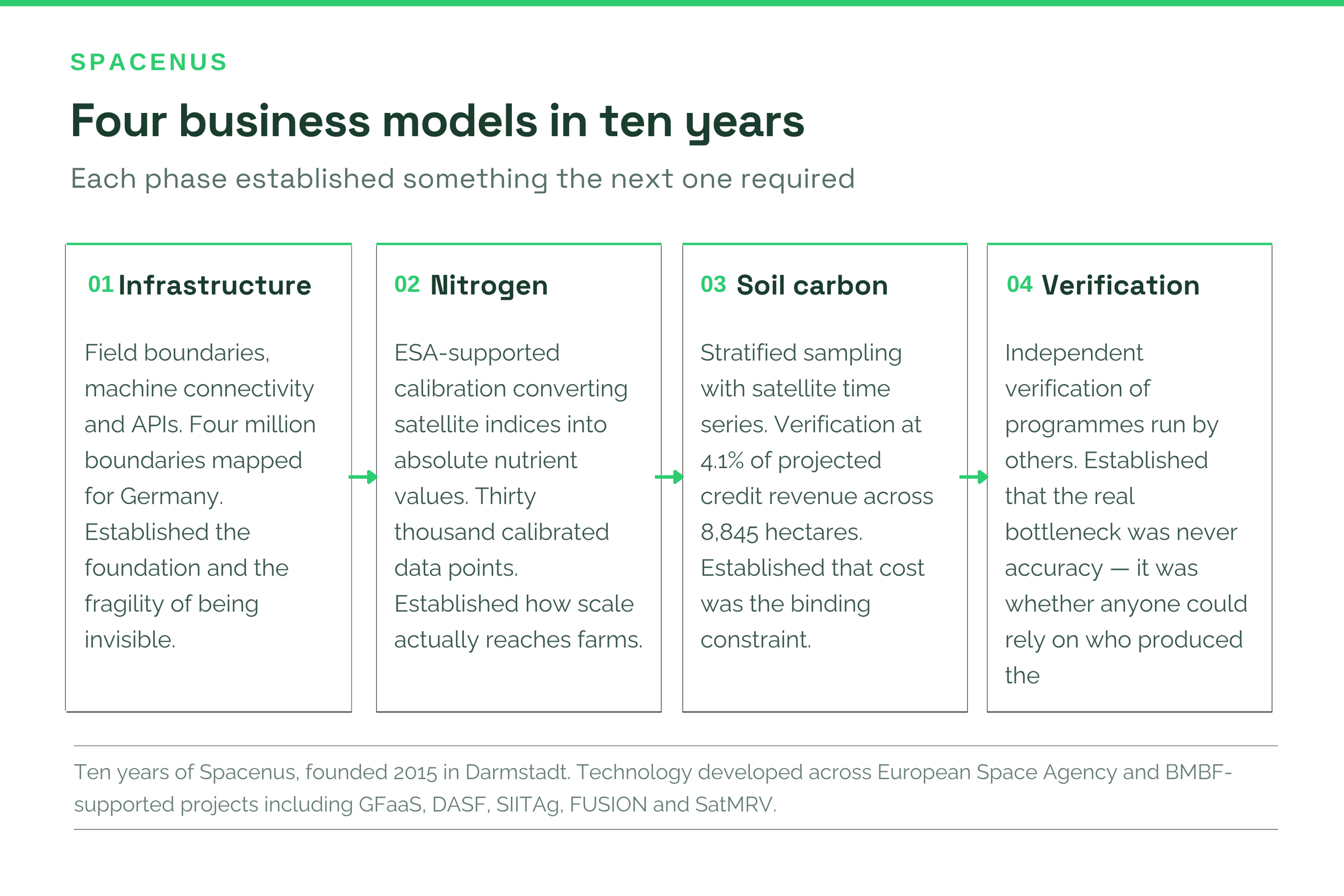
Spacenus is ten years old. Over that decade the company worked through four business models, field boundary infrastructure, satellite nitrogen recommendation, soil carbon mapping, and independent verification, and repositioned around the last rather than adding another product line. The conclusion that matters to a buyer is what the four phases had in common. The bottleneck in this market was never measurement accuracy. It was whether anyone could rely on who produced the evidence.
Why longevity is worth mentioning at all
Enterprise buyers in this sector are, sensibly, reluctant to be anybody’s first customer. Agricultural technology has a long history of well-funded companies that reached Series B and disappeared, leaving programmes half-built and data stranded. Asking a food company to base a regulatory obligation on a two-year-old vendor is asking a lot.
So the useful thing about a decade is not the anniversary. It is that the failure modes have already happened to us, and we are still here.
What started it
The direction came from research rather than from a market gap. Work on climate stress and armed conflict pointed to a specific finding: resource scarcity is a statistically significant predictor of political instability, and food production is where climate stress becomes resource scarcity fastest.
That turned an abstract problem into a concrete one. Before founding Spacenus I had spent several years inside agricultural input manufacturing, running a digital initiative to improve targeting and decision-making. It worked commercially, and it taught the lesson that shaped everything after: solutions that do not work commercially do not scale, however good the intent. Impact needs viability to survive.
Phase one: infrastructure nobody else was building
The early years were spent building what the industry lacked - reliable field boundaries, machine connectivity, APIs for precision application. Four million field boundaries detected and enhanced for Germany, delivered through a geospatial platform.
We became an AgTech API company: rarely visible, deeply embedded. What it established was that field-level analytics need a foundation, and the foundation is boundaries and connectivity. It also established that being invisible infrastructure is commercially fragile, because your customer owns the relationship and can replace you.
Phase two: getting closer to the field
As satellite capability matured we worked with the European Space Agency on nitrogen recommendation systems — converting relative satellite indices into absolute nutrient values using smartphone calibration. Thirty thousand calibrated data points accumulated over the following years.
This phase taught us about the shape of scale. Farmers are the foundation, but agribusinesses and value chain actors are the mechanism by which anything reaches millions of hectares. We stopped trying to build a direct farmer relationship at scale and started strengthening the relationships that already existed.
Phase three: from seeing to solving
Then maps became commodities. Anyone could show a farmer a coloured field. The questions we were asked changed: not how do we see fields better, but how do we account for carbon credibly, build soil carbon baselines at scale, and improve resilience without the cost exploding.
We followed that. Satellite data combined with stratified soil sampling produced scalable soil carbon baselines. With ESA we built practice detection and MRV as operational infrastructure rather than as pilots. Across 8,845 hectares of European arable farmland, verification cost came to 4.1% of projected credit revenue against an industry range of 25–50%.
What the fourth phase taught us, and why we repositioned
By 2025 one pattern had become difficult to ignore. Technology was not the bottleneck. Alignment across the value chain was.
Food and textile companies were using our tools for Scope 3, and what they wanted was insetting rather than offsetting, real reduction at field level without forcing disruptive change on the farmer. But repeatedly the obstacle was not measurement accuracy. It was that nobody in the chain could rely on evidence produced by a party with an interest in the answer.
That is the finding that produced the repositioning. Programme operators who design a programme, recruit the farmers, issue the credits and verify the outcome face a structural conflict, and under the EU Carbon Removal Certification Framework, certification now requires verification by an independent party. What had been a philosophical objection became a regulatory requirement.
“We did not pivot randomly across ten years. We iterated toward the constraint that actually mattered, and it turned out to be independence rather than accuracy.” — Spacenus team
So Spacenus verifies programmes designed and run by others. We issue no credits, operate no farmer programmes, and hold no financial stake in whether a given field passes. That is not a limitation on the business model. After a decade of watching verification fail for reasons that had nothing to do with the science, it is the business model.
What a decade actually buys a customer
Failure modes already encountered. We know what breaks when a programme scales from a pilot to a supply base, because it has broken on us.
Institutional lineage rather than a demo. The technology was developed with ESA and BMBF support across named, documented projects. That is checkable.
A ten-year field data asset. Thirty thousand calibrated nitrogen data points and four million field boundaries cannot be assembled quickly by anyone, including us.
Continuity. The relevant question for a buyer building a 2027 reporting obligation is whether the supplier will exist in 2030. Ten years is not a guarantee. It is evidence.
What comes next
For ten years our customers led us, machinery companies, agribusinesses, farmers, brands. The next phase is about connecting what already exists rather than adding another product: linking farmers, agribusinesses and brands into one system where the evidence is produced once and trusted by everyone in the chain.
That requires the verification layer to be independent, which is where we have ended up. Ten years ago this started with a research finding and a sense of urgency. The urgency has not changed. The understanding of where the actual bottleneck sits has.
If you are building agricultural evidence for a 2027 reporting obligation and want to talk to a supplier who has already made most of the available mistakes, that is a conversation we are glad to have.
Common questions
How long has Spacenus been operating?
Ten years, founded in 2015 in Darmstadt, Germany, with technology developed across a series of European Space Agency and BMBF-supported projects.
Why does Spacenus not issue carbon credits?
Because verification carried out by a party with a financial stake in the outcome is worth less to everyone who has to rely on it, and under EU CRCF, certification requires an independent verifier. Not issuing credits is what makes the verification usable.
What changed in the 2026 repositioning?
The emphasis, not the technology. Ten years of work across field boundaries, nitrogen and soil carbon converged on independent verification as the function the market actually lacked, so that became the organising position rather than one capability among several.
What happened to the earlier products?
They remain and now sit underneath the verification platform. Field boundaries, nitrogen recommendation and soil carbon mapping are components of a verification architecture rather than separate offerings.